MTB Movie
MTB Maintenance - MTB Preparation
Artimino
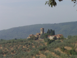
Mtb Tracks Hill Around Florence Artimino CountryMore.....
Morello Mount
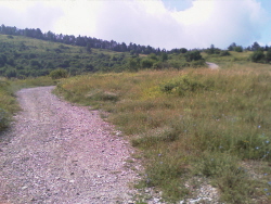
Mtb Tracks Around Florence Morello Mount Legri Volmiano and MattaianoMore.....
Roveta Mount
Florence City direction Scandicci and Rinaldi go up to San Martino alla PalmaMore.....
Renai Park
From Florence go to Rigth Side of Arno River Arno and arrival to Renai Park Signa locationMore.....
Audio
- SLIDESHOW TRAVEL
- TRAVELS
Travels around the World
Amsterdam - Lisboa
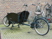
Amsterdam City from 750.000 peoples, where the Electric Bus go up 10' max and the bike is most important trasport peoplesMore...
Lisboa city from about 4 milion of peoples,More...
CRETE ISLAND
-
Crete is the southernmost region of Europe and the largest of the Greek
islands.
Its territory is characterized by three high mountain ranges: the White Mountains (2452 m) to the west, Mount Ida (2456 m) in the center, the mountains Dikti (2148 m) to the east.
Between the mountains lie fertile plains, such as plain Massari, and plateaus of Omalos, Nisi and Lassfthi.
Several streams on the island, though most in almost dry throughout the year.
Along the coast are the typical Almiros, surges of water mixed basins fed by underground rivers.
The beaches are mainly on the northern coast, where the main seaside resorts have sprung up even if the most beautiful beaches are in West Island (Elafonissi, Balos etc.)
After the heavy winter rains (December to March), in Crete following a brief but intense flowering period (weeks) affecting the whole country, from coastal to mountains.
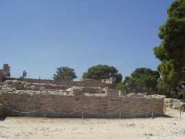
This tree is the symbol of the island cypress tree, whose trunk was used as a column upside down in the Minoan palaces. - ARCHEOLOGICAL SITE OF KNOSSO (Near IRAKLION)
The myth of the Minotaur lives in a picturesque journey through the remains of the Palace of Minos, perhaps the most powerful kings of the Minoan civilization.
The archaeological excavations of the center began in 1878 with the greek archaeologist Kalokerinos but continued between 1900 and 1906 with English Arthur Evans, who financed the excavation and came to the partial reconstruction of the walls and the reproduction of many paintings.
The finds date from the time Neopalatial.
The complex was the seat of the royal family, nobles, officials and the priestly caste.
More than 1000 rooms fueled myth of the Labyrinth.
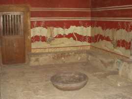
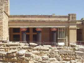
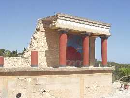
Entering from the courtyard facing the west corridor of the processions and the porch of the great propylaea with copies of frescoes preserved in the Archaeological Museum of Heraklion.
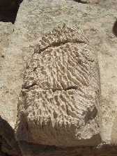
The columns mark the site as shown in the photos below- ARCHEOLOGICAL SITE OF FESTOS (40Km South of IRAKLION)
-
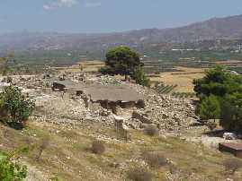
The archaeological site is located in the south of the island about
40 km south of the capital.
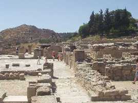
Its importance is due to the discovery of two superimposed buildings, one dating back protopalaziale and one rear.
West entrance on a monumental scale is being increased from propylaea central courtyard.
As at Knossos warehouses for stocks downstairs and real rooms (megaron of the king and queen, the bath for purification) upstairs.
- NATURAL PARK OF SAMARIA (Locality of OMALOS)
National Park since 1962, is a most fascinating areas of the island.
The protected area comprises the south-west around a stream that crosses the White Mountains gorges digging by high walls up to a maximum height of 300m away overlooking the narrowest point up to 3 m.
Here live the last vestiges of Agrimi or krikri, local breed of wild goats.
The path to the Samaria Gorge is pretty long about 13 km of stony path and a height of 1000 meters, starting side of Omalos before reaching the sea.
We have organized tours that take you to the park entrance Omalos side at an altitude of about 1100 meters and then go down walk about 13 km of mountain path to the beach and then take a boat back to sea side. Gorges meet after about 8 km or 5 km walk side Omalos Seaside.
Along the way after 4 km from the start, in a clearing among huge cypress stands the white church of Agios Nikolaos with a slate roof
Then at about 7 km from the summit lies the village of Samaria, now uninhabited, the fourteenth-century church of Osia Maria gave the name to the village and gorges.
You then reach the long-awaited throats after about 8 km from the summit are presented as a series of protruding rock walls streaked with rust that bend at the top forming an arch almost complete (see photo)- ELAFONISSI LANDS (SOUTHWEST TIP)
- White beaches and crystal clear sea, who is a lover of such landscapes and certainly not miss.
PENINSOLA OF SPINALONGA (50 KM WEST OF IRAKLION)
VAI AND PALEOKASTRO LANDS (WEST OF ISLAND)


MTB TRACKS MTB SLIDESHOWS SLIDESHOW TRAVELS SLIDESHOWS TRAVELS TRAVELS TRAVELS TRAVELS TRAVELS PROJECTS Artimino Mount Florence-Artimino Signa Brasil-Recife Portugal Amsterdam Egypte Mykonos United States Merry Christmas Led Morello Mount Florence-Morello Mount Crete Praha Austria Formentera New York Switzerland Crepuscolar Sensor Roveta Mount Florence-Roveta Mount Cube Rodhes Balearic France Niagara Falls Tunisie North Water Sensor Renai Park Florence-Renai Park Germany Sicily Berlin Ibiza Paris Tunisie South Vaiano Bike Track Florence-Vaiano Ibiza-Formentera Swizerland Brasil Italy Paros Twc MTB GPS TRACKS
MTB
Holland-Amsterdam Tunisie Chambord Lisboa Portugal Unghery Gps Tracks Mtb Maintenance Mykonos BERLUSCONI
Corsica London Rep.Ceca PROJECT
Google Earth Tracks Mtb Physical Training Paris Images Crete Maroco Sardinia Equalizator Excel Tracks Anearobica Threshold Paros Slideshows Cube Mexico Sicily Magnetoterapy
